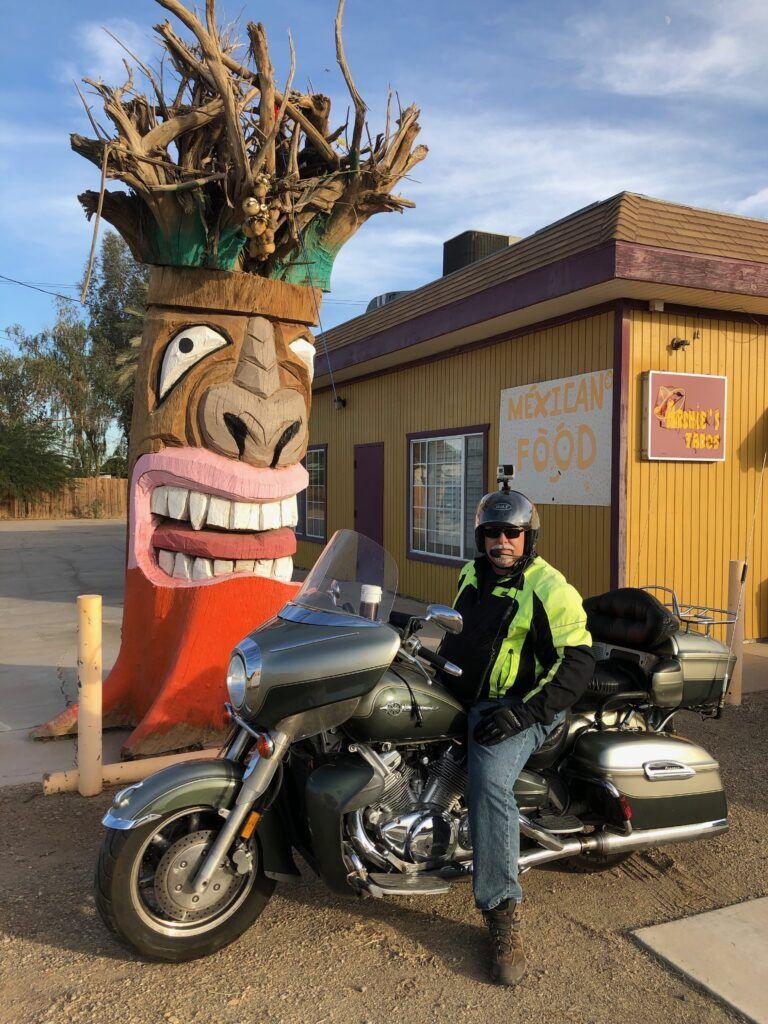
One of my absolute favorite things to do when I am out riding around is to find roadside oddities and attractions. I have been known to make many a U-turn while driving down the road. This page will be dedicated to any roadside attractions that I have found in the state of California.
It will be a constant work in progress as I will add new oddities and attractions every time I find one. Make sure you check back often for new updates. Better yet, subscribe to my site so you will be informed each time content is added. Don’t worry, no spam here. I send just one email a month, on the final Friday. Subscribe Here
Alcatraz
Location: Alcatraz Island
City: San Francisco
Region of State Located: Central/West
Google Maps Pin
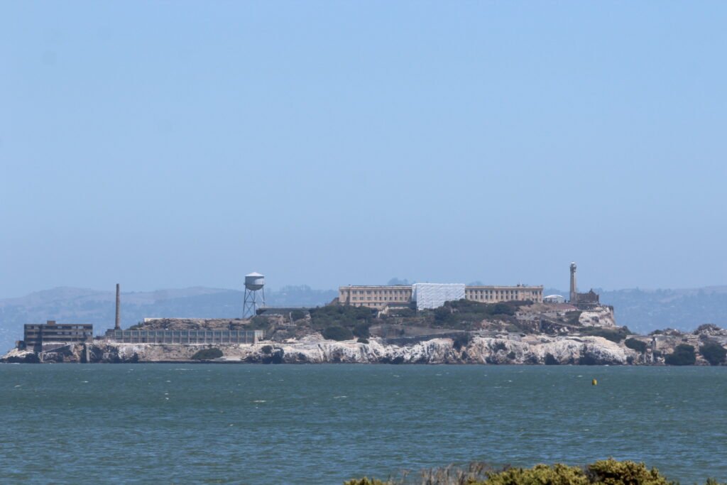
Floating ominously in the middle of San Francisco Bay, Alcatraz Island is perhaps America’s ultimate “roadside” attraction, if your road happens to be an ocean ferry lane! Known as “The Rock,” this legendary 22-acre island originally served as a 19th-century military fort and lighthouse point before transforming into the nation’s most secure federal penitentiary in 1934. It infamously housed notorious mobsters like Al Capone and “Machine Gun” Kelly, all kept in check by freezing currents and razor-sharp security, before closing in 1963 due to sky-high operating costs. Today, it operates as a fascinating National Park Service site complete with an award-winning cellhouse audio tour narrated by former inmates and guards who give you a bone-chilling, vivid look at life behind bars.
Despite its rugged reputation, Alcatraz is surprisingly accommodating for active seniors, though it does feature a steep, 130-foot elevation gain from the ferry dock up to the main cellhouse (roughly equivalent to climbing a 13-story building). Fortunately, the park runs an accessible, electric shuttle bus called the S.E.A.T. (Sustainable Accessible Transportation) tram for anyone with mobility challenges or limited stamina. Once inside the main cellhouse building, everything is smooth, level, and well-lit. Fully accessible public restrooms and drinking fountains are conveniently located both at the ferry landing dock and inside the cellhouse, making comfortably paced visits a breeze.
Sidenote: I took the picture from Chrissy Beach as I did not want to pay the almost $50 for the round trip ferry ride. It would of been $100 for my wife and I. Call me cheap... umm… frugal…lol.
Azusa Rt 66
Location: 675 E. Foothill Boulevard,
City: Azusa
Region of State Located: South/West
Google Maps Pin
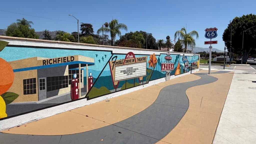
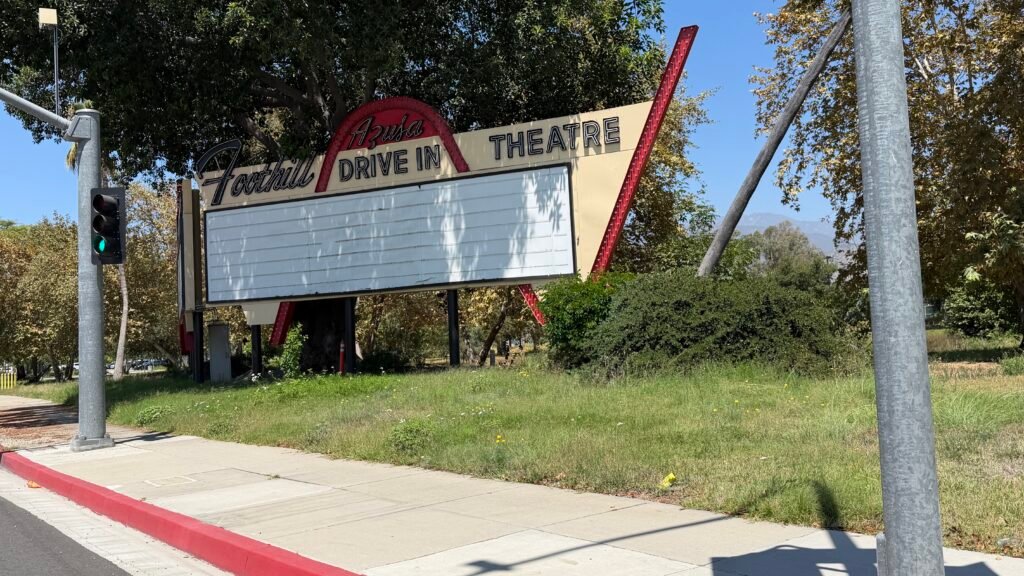
Roll back the clock and picture this: it’s the early ’60s, the Disney flick is starting, and 1,500 cars are lined up with the windows down and the popcorn flowing. The Azusa Foothill Drive-In opened in December 1961 with Disney’s Babes in Toyland, and it ran for just over forty years before closing on December 28, 2001. When it shut down, it was the last drive-in theater on Route 66 west of Missouri, though other sources say west of Oklahoma, so I’d pick one carefully or just say “one of the last.” The land, a 17-acre site, was sold to Azusa Pacific University for $6.1 million in 2001. Preservationists weren’t ready to let the glow fade, and the state designated it a landmark in February 2002, even though the Azusa city council voted 4 to 1 against it. The screen, concession stand, and speaker poles didn’t survive, though: they were razed by 2005 to make room for a parking lot. The sign is what’s left, and what a survivor it is. The university spent about $50,000 and two years restoring it and now uses it for campus announcements in English and Spanish. So the same marquee that once announced double features now announces campus events.
You’ll find the sign at the corner of Foothill Blvd and Alosta Ave, right where Route 66 runs through Azusa and now on Azusa Pacific University property. That’s the Route 66 connection: Foothill Blvd is the Mother Road here, and the sign is one of the most photographed pieces of its roadside past. A fun Azusa bonus: the town’s catchy slogan is that it’s “the A to Z of the U.S.A.” Since Azusa sits on a stretch of Route 66 in the San Gabriel Valley, it pairs well with other classic stops in the area, so it’s easy to turn this into a Route 66 afternoon.
Senior-friendly tips: This is a “drive up, park, snap, and go” stop, so it’s about as low-effort as roadside attractions get. You can admire the sign from the sidewalk without a long walk, and it’s visible from a car if you’d rather stay put. I took this at a red light…lol. Because it’s a neon sign, it looks best late in the day around dusk, but I couldn’t confirm whether it’s lit every night or just for events, so it’s smart to call ahead or check recent photos. Watch the traffic on Foothill Blvd when crossing, and bring a camera. This one is made for photos.
Battery Point Lighthouse
Location: Lighthouse Way
City: Crescent City
Region of State Located: North/West
Google Maps Pin
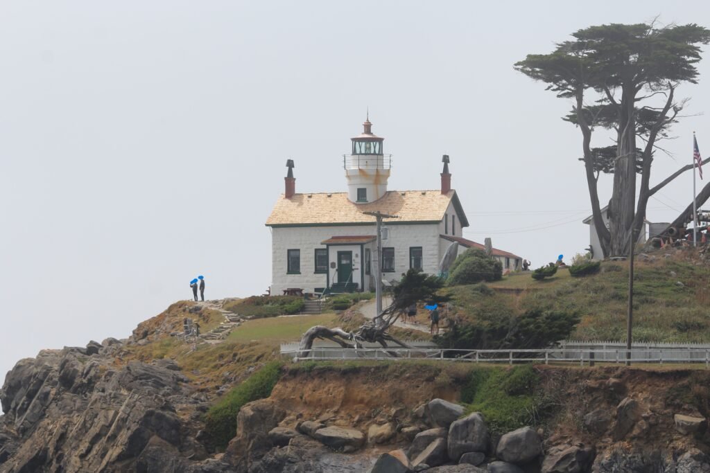
Perched dramatically on a tiny tidal island in Crescent City, California, Battery Point Lighthouse is one of the most charming road-trip detours along the Pacific Coast Highway. First lit in 1856, this historic landmark has survived fiery shipwrecks, howling coastal gales, and even a massive tsunami in 1964, proving it is far tougher than it looks. Named after three salvage cannons mounted on the point in 1855, the station is still run by live-in museum caretakers who give guided tours of the historic living quarters and the steep light tower. The catch? Nature controls the front door. The lighthouse sits on a tiny island that is completely cut off by the ocean during high tide, making it accessible only via a 200-foot sandy and rocky land bridge when the tide recedes. Make sure you pay attention to the tides or you will be walking in knee high water back to the mainland after visiting the lighthouse!!!
For active seniors, visiting Battery Point is an absolute treat, but it does require a bit of tactical planning! Accessibility depends heavily on your mobility: crossing the exposed ocean bed involves navigating loose gravel, slippery rocks, and damp sand, so leave the sandals in the car and wear sturdy, non-slip walking shoes or hiking boots. The walk across is short, but there is a steep narrow staircase inside the tower if you choose to climb to the top. Crucially, there are no public restrooms on the island itself, so you’ll definitely want to use the public facilities near the parking lot at the foot of A Street before attempting the trek.
Beach Boys Historic Landmark
Location: 3701 W 119th St
City: Hawthorne
Region of State Located: South/West
Google Map Pin
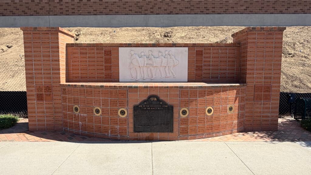
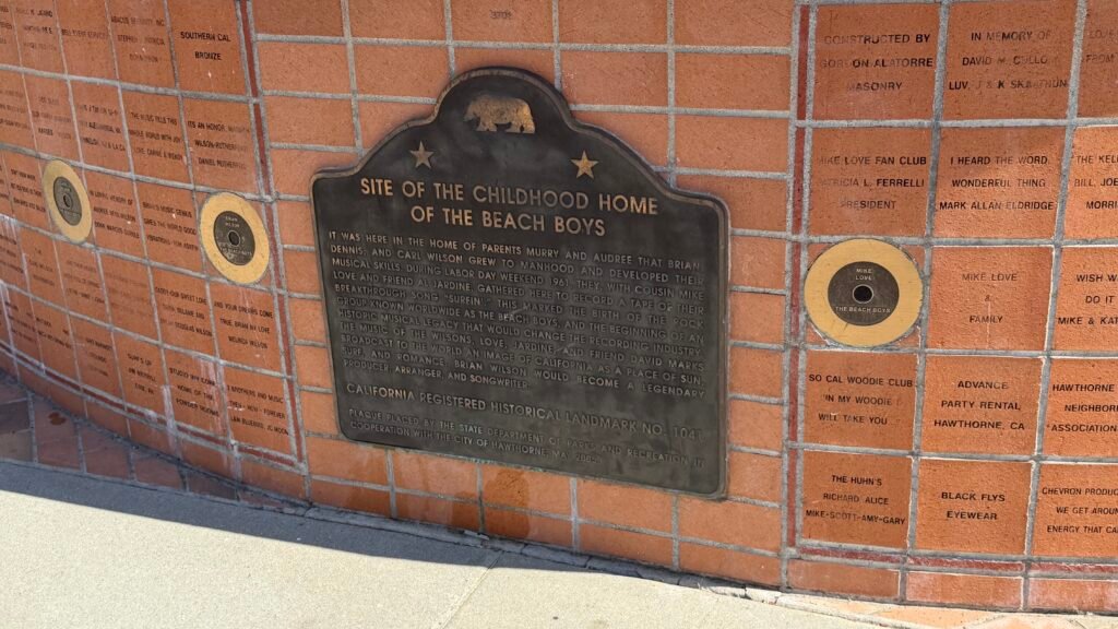
Fun, fun, fun until your daddy takes the T-Bird away? Not quite, but you can still visit the spot where the Beach Boys got their start. The Beach Boys Historic Landmark (California Historical Landmark No. 1041) marks the former site of the Wilson family home, which was demolished in the mid-1980s during construction of the Century Freeway. It’s where brothers Brian, Dennis, and Carl Wilson grew up. Over Labor Day weekend in 1961, they gathered here with cousin Mike Love and friend Al Jardine to record their breakthrough song “Surfin'”. Songs were written in Brian’s bedroom, and harmonies were polished in the living room, about five miles from the surf they sang about. The house is gone, but the site was approved as a state landmark by a unanimous vote in August 2004, and the monument was dedicated on May 20, 2005. A Beach Boys superfan led the landmark campaign. Not bad for a group that started out harmonizing in a living room.
The monument itself is a charming brick-and-tile marker with a state plaque. It also features a bas-relief of the 1963 Surfer Girl album cover, and the bricks are engraved with the names of donors, Wilson family and friends, and the landmark committee, so you can play “spot the name” like a musical scavenger hunt. Fair warning: this is a quirky roadside stop, not a theme park. The monument sits at the end of a dead-end street next to a sound wall built to mute freeway noise, so you’ll hear traffic, and since LAX is just to the south, expect jets overhead (a surprisingly fitting soundtrack for a band that sold the California dream). The city of Hawthorne also held a re-unveiling celebration at the site in June 2025, so it’s getting some fresh attention. Admission is free, and there are no posted hours that I could find, so it’s a drop-in stop.
This is a quick, low-effort visit. You’re viewing a monument from a residential street, not hiking to it, so it suits most mobility levels. Parking is on the street in a residential neighborhood, so be courteous to neighbors. Bring the playlist, roll the windows down, and sing along. Nobody’s judging, and the Wilsons would approve.
Bill and Bob Meistrell Memorial
Location: 270 Portofino Way
City: Redondo Beach
Region of State Located: Centra/South/West
Google Maps Pin
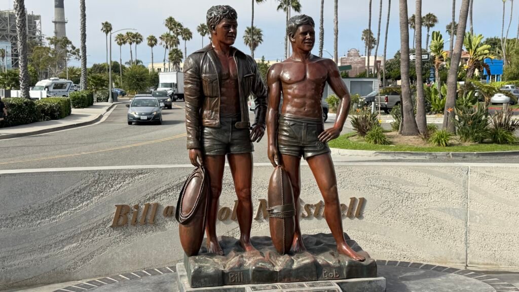
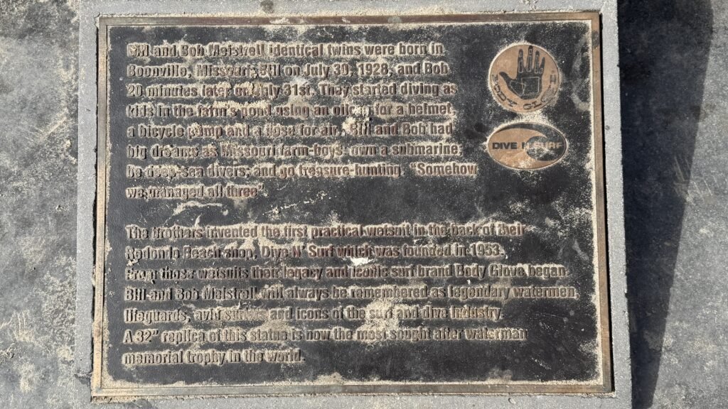
Standing along the scenic waterfront in King Harbor, the Bill & Bob Meistrell Memorial is a legendary tribute to two brothers who permanently altered surf and dive culture. Unveiled in 2014, this bronze statue depicts the identical twin founders of Body Glove wearing early neoprene wetsuits and diving gear. Bill and Bob Meistrell were pioneer watermen who helped popularize commercial diving and recreational water sports in California, co-founding Body Glove right here in the South Bay in 1953. The lifelike statue captures the adventurous, fun-loving spirit of the pair, making it an iconic photo op where you can stand alongside two giants of ocean lore.
This roadside attraction is remarkably easy to visit. Situated right along the flat, paved pedestrian walkway near Portofino Way, the memorial requires zero climbing or rough terrain to access. The harbor paths are wide, smooth, and perfect for a relaxing, steady stroll while enjoying the ocean breeze and watching boats glide in and out of the marina. Clean, accessible public restrooms, benches, and water fountains are located nearby along the harbor boardwalk, and ample paid parking (including designated accessible spaces) is available in the adjacent surface lots and structures. Free parking is almost impossible to find in the area.
Center Of The World
Location: 1 Center of the World Plaza
City: Felicity
Region of State Located: Southeast Tip
Google Maps Pin
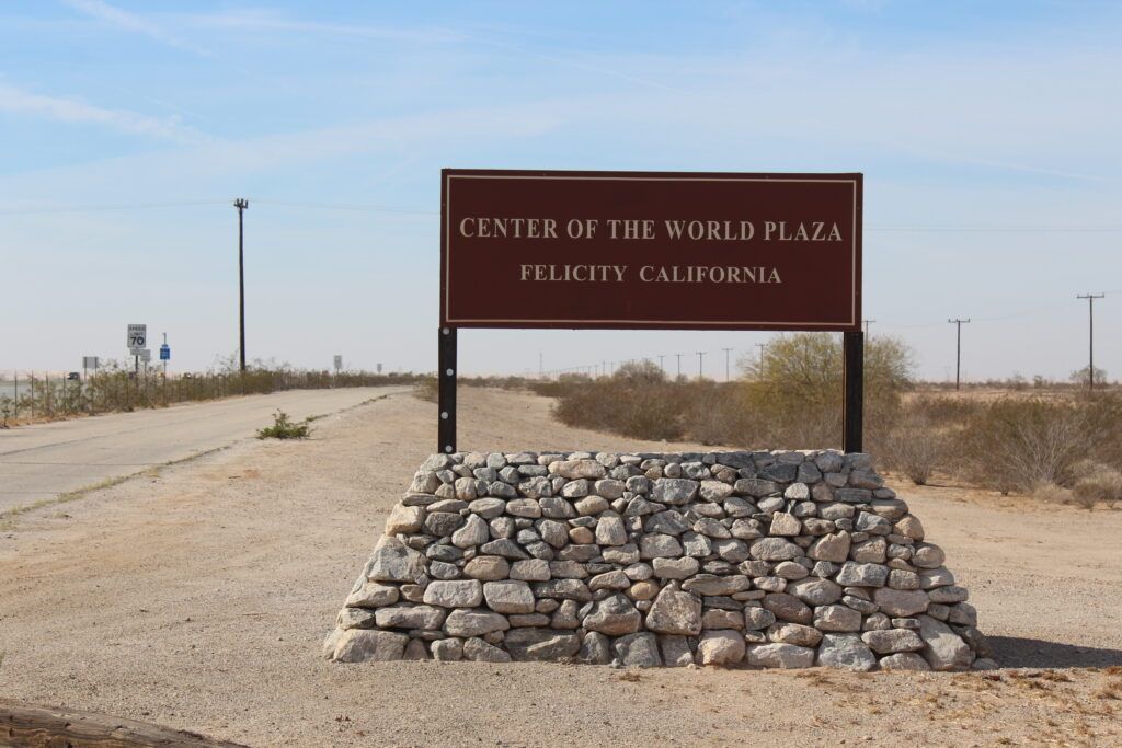
Located in the tiny desert town of Felicity, California, the “Center of the World” is exactly what it sounds like… according to one very determined man and a few official-looking plaques. This unusual attraction was created by Jacques-André Istel, who spent decades developing Felicity as a cultural and spiritual destination. In 1985, the County of Imperial officially recognized this exact spot as the Center of the World, complete with a granite monument and a declaration that visitors can literally stand at the middle of everything. Whether you take that claim seriously or with a grain of desert sand is entirely up to you.
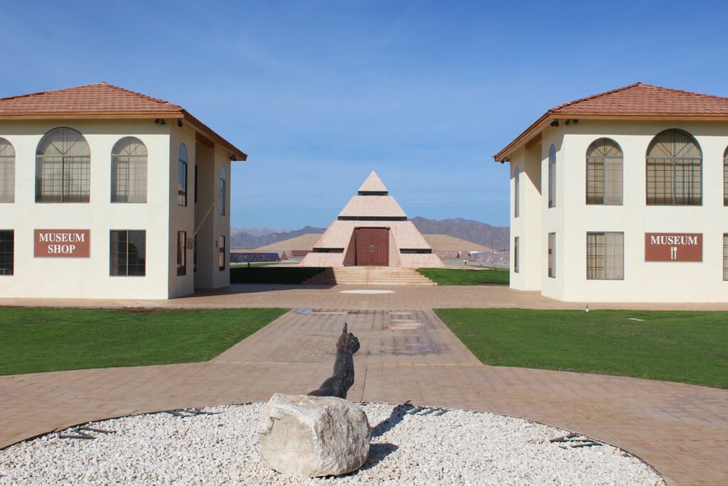
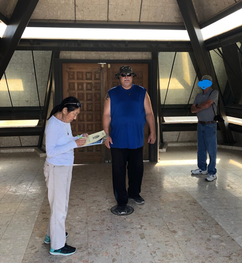
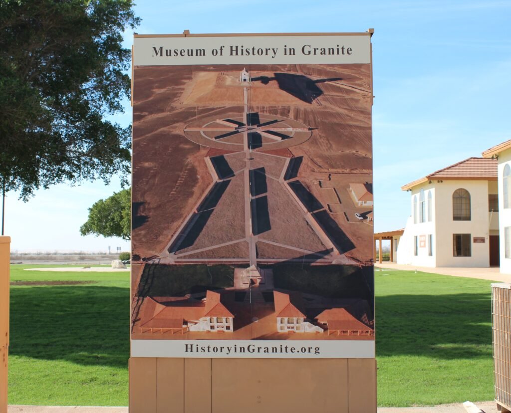
A visit here is simple, quiet, and surprisingly thought-provoking. You’ll find a small plaza, monuments, a short walkway lined with inscriptions, and a peaceful desert backdrop that makes the whole experience feel oddly meaningful. There’s even a small museum and a nearby church that adds to the town’s artistic and philosophical vibe. Most people don’t stay long, but almost everyone leaves smiling, if only because they can now truthfully say they’ve stood at the center of the world and taken a selfie ($2 for an official certificate) to prove it. It’s quirky, sincere, and wonderfully weird in the best roadside-attraction way.
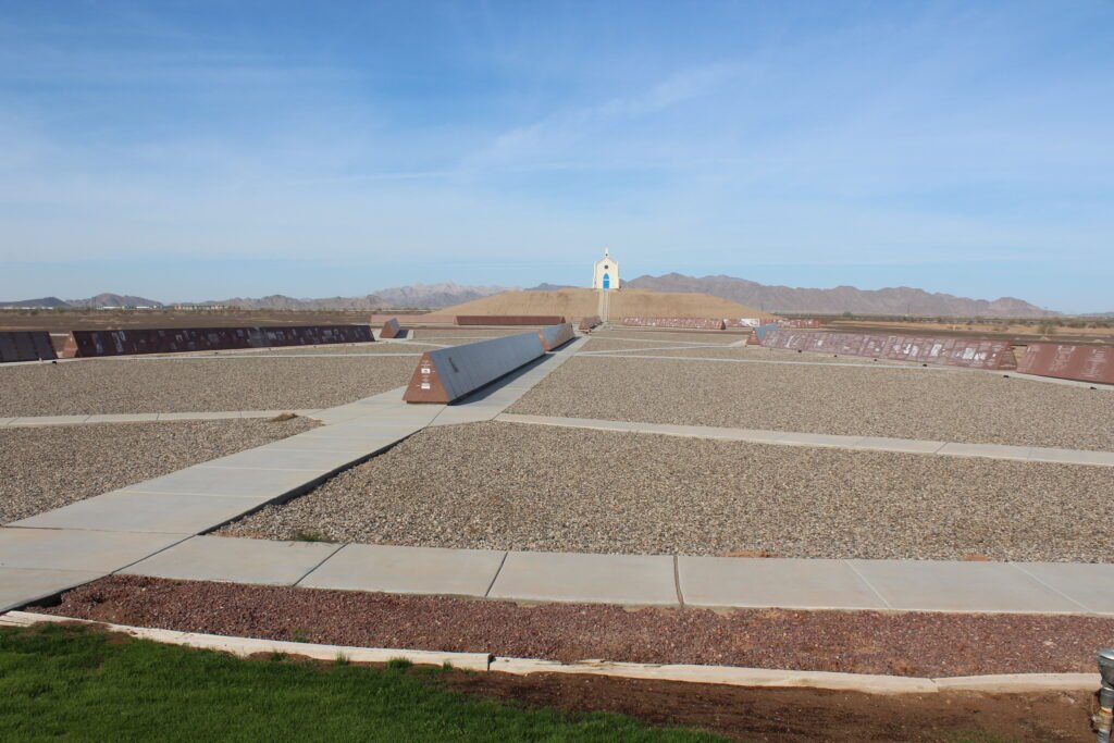
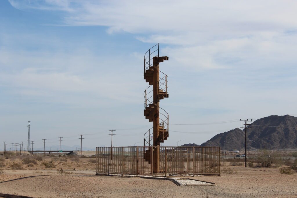
The center of the world is located within the pyramid that houses “the spot” designated by a bronze disk on the pyramid floor. This roadside attraction features the “Center of the World”, a portion of the Eiffel Tower Staircase, a sundial replica of the “Hand of the God” which points to a church up on a large hill (which you can walk up to), and large rows of granite memorial walls. There is a cost of $3 to enter.
Chicken Boy (RT 66)
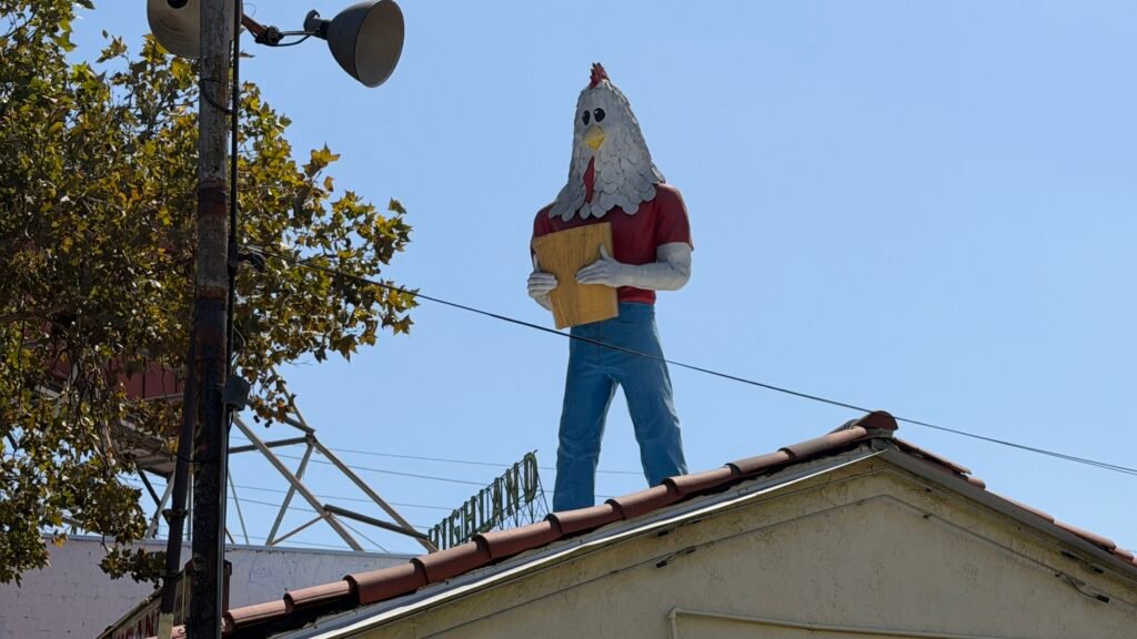
Location: 5558 N Figueroa St,
City: Los Angeles,
Region of State Located: Central West
Google Maps Pin
Perched triumphantly atop a building along historic Route 66 in Los Angeles’ Highland Park neighborhood, Chicken Boy is the undisputed “Statue of Liberty of Route 66.” Standing a towering 22 feet tall, this surreal fiberglass creation features the head of a chicken atop the body of a man holding a bucket of fried chicken. Originally erected in 1969 above a fried chicken restaurant on Broadway in downtown LA, the beloved bird was saved from destruction by art director Amy Inouye when the restaurant closed. After living in storage for over two decades, Chicken Boy made a triumphant comeback in 2007, roosting high above Future Studio Design & Gallery on North Figueroa Street, where he continues to delight passersby and roadside pop-culture aficionados.
For anyone taking a driving tour of Historic Route 66, Chicken Boy is the ultimate quick and easy roadside photo stop. Because the giant fiberglass statue sits high on a rooftop, viewing it requires no walking or climbing at all, you can easily admire and photograph him directly from the sidewalk along Figueroa Street. The surrounding street and sidewalk areas are flat and paved, making it simple to navigate. While there are no dedicated public restrooms at the monument itself, the vibrant Highland Park neighborhood is packed with charming, level-access cafes, bakeries, and shops where you can stop for lunch, use facilities, and enjoy a relaxed stroll. I was able to grab free curbside parking to grab this photo.
Cloud Museum
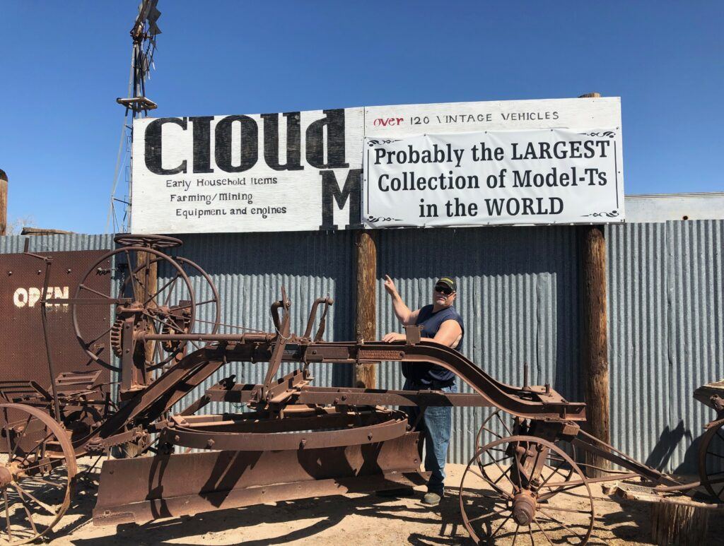
Location: 1398 York Road
City: Bard
Region of State Located: Southeast Tip
Google Maps Pin
The Cloud Museum in Bard, California, is a hidden gem for anyone who enjoys old cars, classic trucks, and the kind of roadside stops that feel like stepping into someone’s personal collection, from the 1900’s because that’s pretty much what it is. This private museum is packed with vintage vehicles, including Model T cars, early trucks, tractors, and other mechanical throwbacks from a bygone era. From the road, it doesn’t look like much, which makes the discovery even better when you realize just how much history is tucked away behind the gates.
Inside, you’ll find rows of preserved machines along with old signs, tools, and memorabilia that bring early American transportation and rural life back to life. It feels less like a formal museum and more like visiting a really enthusiastic collector who decided to share his passion with the world. There are old buildings set up they way they were years ago like an old post office with PO boxes and all. There’s a lot to look at, plenty to photograph, and no pressure to rush through. Whether you’re a serious car buff or just enjoy seeing how people used to get around before GPS and cup holders, the Cloud Museum offers a surprisingly fun and memorable stop in the middle of the desert. There is a $10 admission fee.
Cucamonga Gas Station (RT 66)
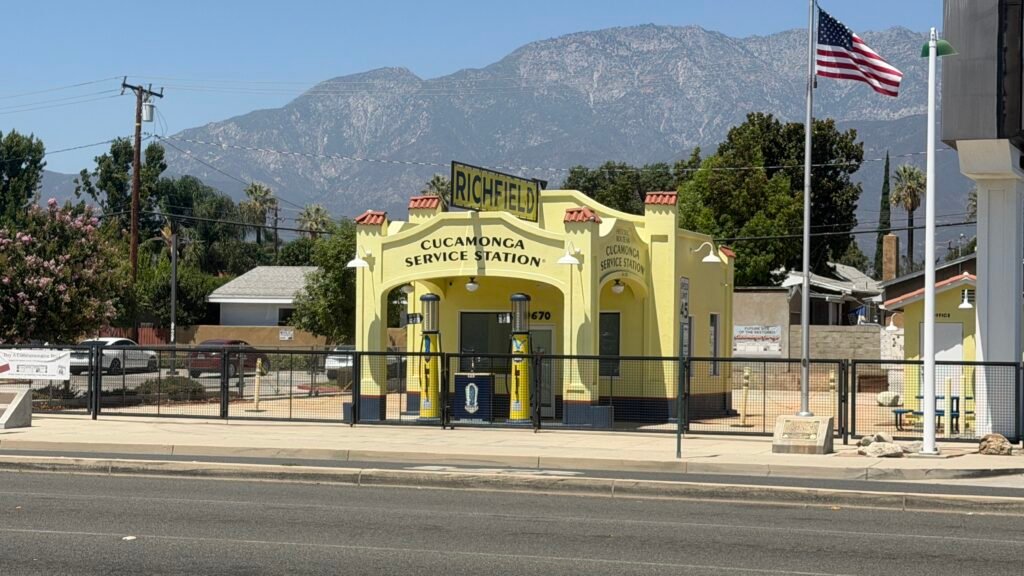
Location: 9670 Foothill Blvd,
City: Rancho Cucamonga
Region of State Located: South/West
Google Maps Pin
Henry Klusman built this Spanish Colonial Revival gem in 1915 on a road that became Route 66 ten years later. It fueled up Mother Road travelers as a Richfield station from the 1930s to the 1960s, then closed in 1971 when the interstates stole its customers. After decades of neglect, a nonprofit stepped in, raised about $100,000, and restored it with a bright blue, red, and yellow color scheme and an iconic Richfield sign. It’s now a Route 66 museum and gift shop on the National Register of Historic Places. Not bad for a gas station that once sat in storage.
Admission is by donation. I passed by this on a Monday and they were closed so I parked across the street and grabbed this picture. I believe they are open from Thursday to Sunday.
Elmer’s Bottle Tree Ranch (RT 66)
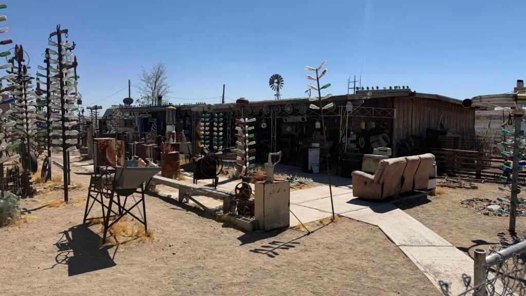
Location: 24266 National Trails Hwy (RT 66)
City: Oro Grande
Region of State Located: South/Central
Google Maps Pin
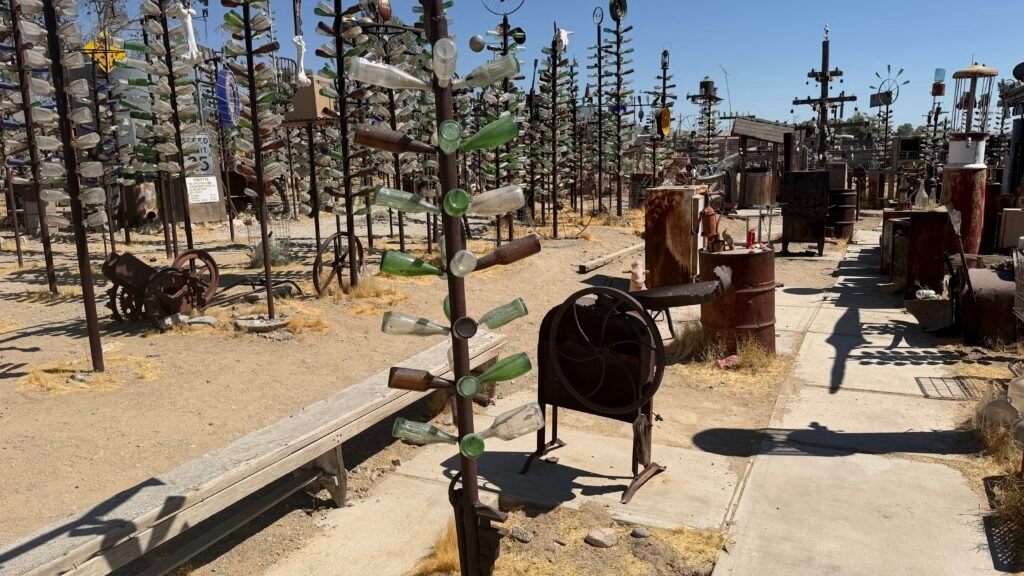
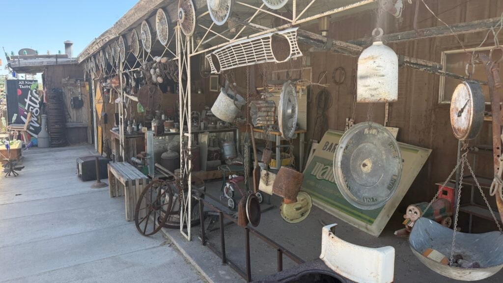
Trees that grow in the desert are one thing, but trees that sparkle, clink, and whistle in the wind are another. Elmer’s Bottle Tree Ranch is a folk-art forest on two acres, a free, open-air gallery on Historic Route 66 between Barstow and Victorville. The story starts with a father and son who hiked the desert collecting old glass bottles just for fun. Elmer Long inherited the hoard and built his first bottle tree in 2000. That same day, he noticed Route 66 travelers pulling over to photograph it. That was all the encouragement he needed. He went full-time on bottle forest creation in 2002, welding metal pipe into “branches” and topping each tree with a quirky salvaged treasure. Today there are about 200 trees, along with a scrapyard’s worth of oddities scattered among them, including rusted-out vehicles, old signs, typewriters, and hubcaps. Elmer died in June 2019, but the ranch reopened in September 2019 and has been open since. A caretaker now keeps the forest growing, so there’s always something new to find. Think of it as the world’s most colorful recycling project. There’s no fee to enter, though donations are accepted, and a few dollars helps keep the glass gleaming. Hours seem to be flexible.
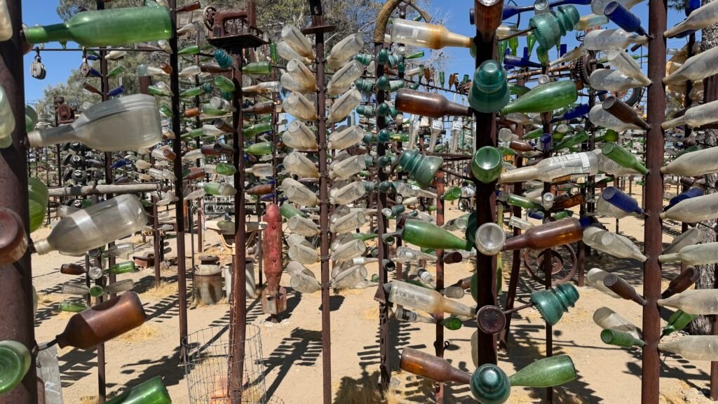
Senior-friendly tips: The ranch is an outdoor wander on a sandy lot, so it’s best for visitors who are comfortable walking on loose, uneven ground. The pipes are tightly arranged, with enough room to walk between most of them, so expect narrow paths and take your time. Wear sturdy, closed-toe shoes, a hat, and sunscreen, and bring water, especially in the summer, because this is the Mojave. I would not recommend visiting in August as I did. The temperature was 118 degrees!!! After a few photos my iPhone overheated…lol
Foliage Hair Statue
Location: 1401 Pacific Coast Hwy
City: Redondo Beach
Region of State Located: South/West
Google Maps Pin
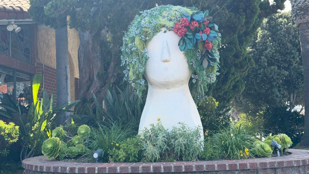
Long before Chia Pets were a thing, a hair studio in Redondo Beach decided the best way to advertise great hair was a 13-foot-tall head with a leafy green ‘fro. The statue stands outside Joe Oliveri’s salon at 1401 S. Pacific Coast Hwy, at the corner of PCH and Avenue F, and sources say it has been drawing double takes for about 40 years. The plantings are now artificial, which means no watering and no bad hair days. The owner likes to dress it up for the occasion, with hair rollers at times and bunny ears for Easter, so it may look a little different each time you visit. Viewing is free, since it’s a statue outside a working salon.
It’s an easy roadside stop with no walking required, so it suits just about any mobility level. PCH is busy, so stick to the sidewalk and take your photo from a safe spot. I took this while stopped in traffic…lol
Golden Gate Bridge
Location: Golden gate Bridge
City: San Francisco
Region of State Located: Central/West
Google Maps Pin
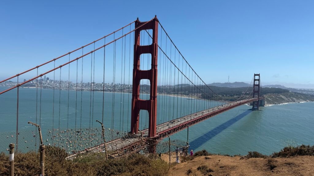
Stretching majestically across the San Francisco Bay, the Golden Gate Bridge is the crown jewel of roadside attractions. Opened in 1937, this 1.7-mile Art Deco masterpiece was once called “the bridge that couldn’t be built” due to ferocious winds, thick fog, and deep oceanic tides. To the delight of millions, chief engineer Joseph Strauss proved the skeptics wrong, painting it in its famous “International Orange” color, a vibrant shade chosen specifically to make the structure pop against the swirling coastal fog. Today, it remains one of the most photographed engineering marvels on the planet, offering staggering views of the Pacific Ocean, Marin Headlands, and the San Francisco skyline.
For active seniors, the bridge is remarkably accessible, featuring a paved, level east sidewalk dedicated to pedestrians. The walk from the south plaza out onto the span is completely flat, making it easy to stroll as far as you like before turning back. However, be prepared for high winds and traffic noise from the adjacent roadway. Modern amenities are located at the south end plaza, where you will find accessible public restrooms, drinking fountains, a gift shop, and a café. Parking right at the welcome center fills up fast, but drop-off zones and nearby accessible parking spaces make arriving convenient.
Note: Traffic is brutal getting to/visiting this bridge. You will need to have a boatload of patience to visit this bridge. Also, be aware, do not leave anything of value visible in your car if you decide to get out and walk the bridge. Smash and Grab’s are extremely common at most of the parking areas. There are signs everywhere warning you of this.
Galleta Meadows Estate
Location: 1700-1844 Borrego Springs Rd
City: Borrego Springs
Region of State Located: Southern Tip
Google Maps Pin
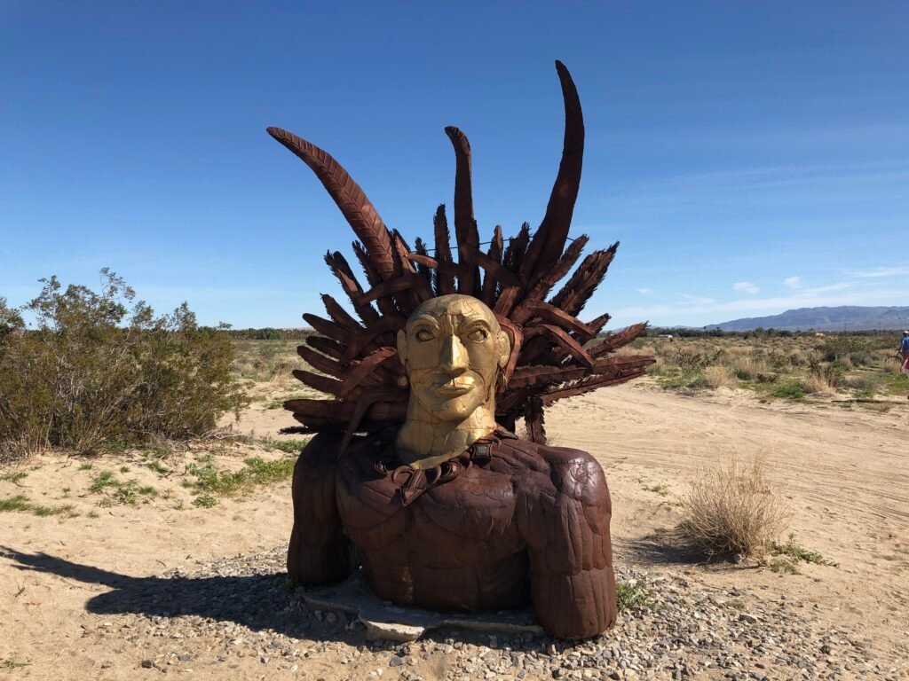
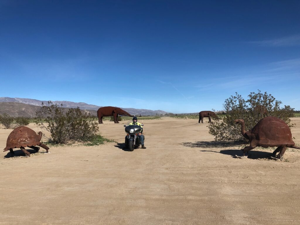
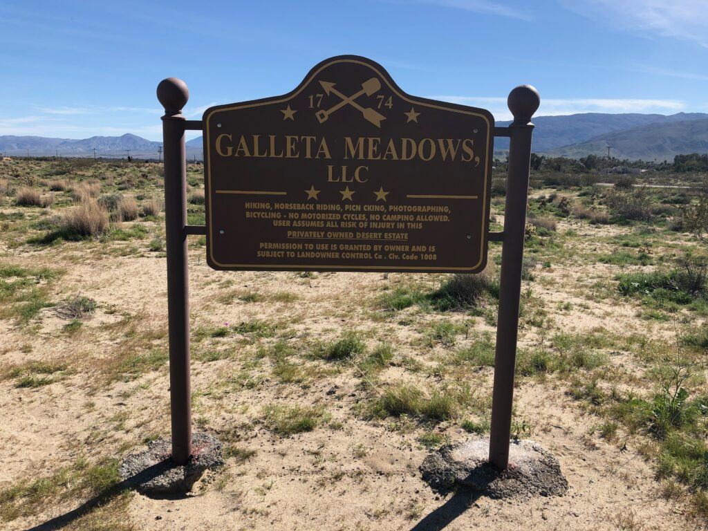
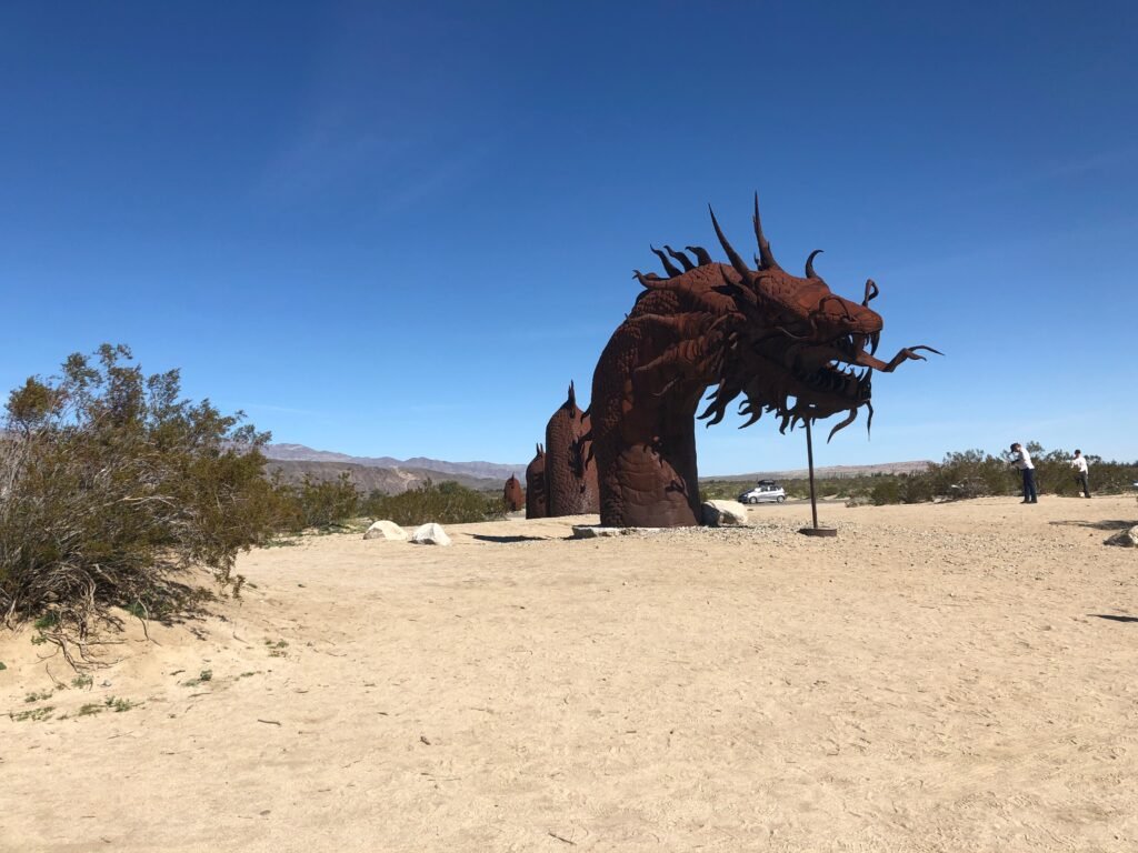
Galleta Meadows Estate in Borrego Springs, California, is what happens when someone decides the desert needs more giant metal dinosaurs, camels, and mythical creatures, and then actually makes it happen. Spread out along the roads on the edge of town, this massive outdoor art installation features over 100 life-sized and larger-than-life metal sculptures created by artist Ricardo Breceda. Funded by philanthropist Dennis Avery, the project has transformed miles of open desert into a free, open-air gallery where prehistoric animals, pioneers, and fantastical figures casually coexist under the blazing sun.
Driving through Galleta Meadows feels like stumbling into a sci-fi movie, a history lesson, and an art exhibit all at once. One minute you’re passing towering serpents and saber-toothed cats, the next you’re spotting a stagecoach or a giant scorpion in the distance. There are no gates, no admission fees, and no set path, just roads, desert views, and constant “Did you see that?” moments. Whether you explore by car, bike, or on foot, it’s an unforgettable roadside stop that proves the middle of nowhere can sometimes be the most interesting place of all.
Hollywood Forever Cemetery (RT 66)
Location: 6000 Santa Monica Blvd
City: Los Angeles
Region of State Located: South/West
Google Maps Pin
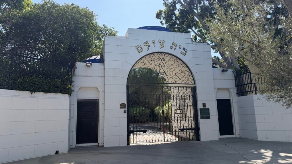
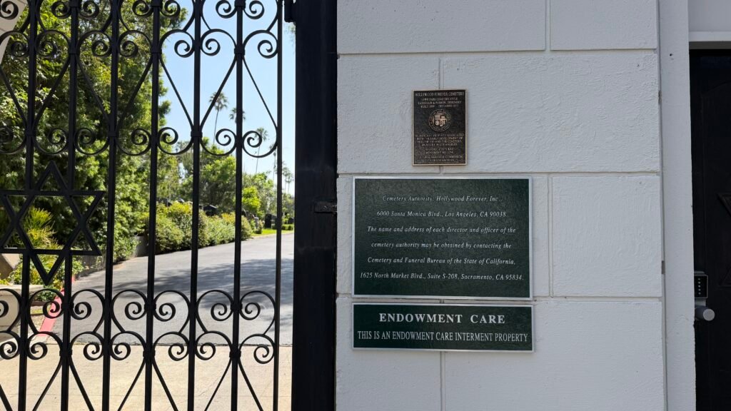
Is it a cemetery or a star-studded history lesson? Both. Hollywood Forever, at 6000 Santa Monica Blvd, was founded in 1899 and is Hollywood’s oldest cemetery. In fact, Paramount Studios was built on the back half of the original grounds. Its residents include Rudolph Valentino, Judy Garland, Charlie Chaplin, Johnny Ramone, and Mel Blanc, whose epitaph is the famous sign-off of the cartoon characters he voiced. It joined the National Register of Historic Places in 1999. There’s even a Route 66 tie-in: before its makeover, the cemetery’s frontage along Route 66 (Santa Monica Blvd) was leased out as a strip mall. These days it hosts outdoor concerts and summer movie nights, projected right onto a mausoleum wall.
Entry is free, so you can pick up a map at the flower shop and wander at your own pace. Hours are typically 8 AM to 5 PM but can vary on holidays, so check ahead. Restrooms are in the parking lot behind the Cathedral Mausoleum in the southeast corner, and the Fairbanks Lawn has a designated wheelchair area with easy access to restrooms. Wear comfortable shoes, since the terrain is grassy and uneven in places, and bring water and sunscreen. The grounds are large, so you can drive or walk to a few highlights and skip the rest. This is a working cemetery, so be respectful and expect closures or rerouting if a funeral is taking place. Dogs aren’t allowed. You may also spot a few peacocks, according to one visitor.
Note: Unfortunately it was closed when I was there. Maybe next time. This is where I took the photo of the Hollywood sign.
Hollywood Sign
Location: Los Angeles
City: Los Angeles
Region of State Located: South/West
Google Maps Pin
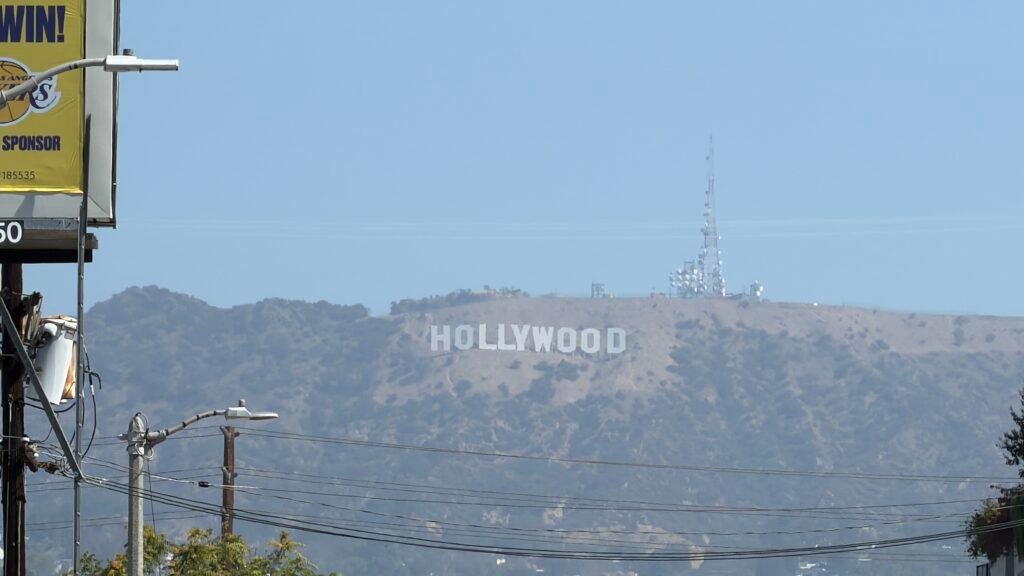
This one started life as a real estate ad. The sign went up in 1923 spelling out “Hollywoodland” to promote a housing development, and its letters, around 45 feet tall, were only meant to last a year or two. Eighteen months, tops. A century later, it’s the most photographed hillside in Hollywood (the “land” was dropped in 1949, and the whole sign was rebuilt in 1978 with help from celebrity donors). It sits on Mount Lee in Griffith Park, about 13 miles northwest of Downtown LA. Here’s the catch: the area right around the sign is fenced off and heavily monitored, so no touching the letters. You’ll admire it from a distance, and the sign isn’t lit at night, so go in daylight.
For seniors, the easiest viewpoint is Griffith Observatory, which has a free grounds and entry with parking running about $10 an hour. Hollywood & Highland is another very easy spot, and it was built to frame the sign. Lake Hollywood Park has benches and a wide-open view, and the Lee Drive viewing area is one of the closest legal spots. Parking is limited at many viewpoints and residential streets are often restricted, so go early, aim for mornings or late afternoons, and consider a rideshare. A weekend DASH shuttle also runs from the Vermont/Sunset Metro station up to the Observatory.
Note: I took this picture from outside the Hollywood Cemetery entrance on Santa Monica Blvd.
Imperial Date Gardens
Location: 1304 York Road
City: Winterhaven
Region of State Located: Southeast Tip
Google Maps Pin
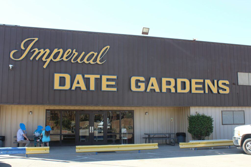
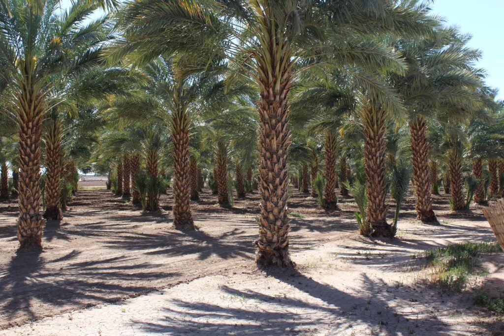
Imperial Date Gardens in Winterhaven, California is a classic desert-side stop that’s both tasty and picturesque. This family-run date farm specializes in premium Medjool dates, hand-selected and harvested in the ideal climate of the Bard Valley, just across the Colorado River. It’s the kind of place where the simple sweetness of the fruit matches the laid-back charm of the region, and you’ll likely smell sugar in the air before you even see the date palms. You won’t find a flashy tourist trap here, just old-fashioned quality, delicious samples, and plenty of gift boxes to satisfy both your sweet tooth and your holiday shopping list.
While dates might not be the first thing you think of on a California road trip, a stop here feels like stumbling into a delicious slice of agricultural history. In addition to classic jumbo Medjools, the garden’s seasonal offerings include chocolate-covered dates, nut-stuffed varieties, and baked goods like date nut bread, perfect fuel for the road ahead. The farm store is typically open during the Medjool season (late fall through early spring), so timing your visit right means you can enjoy fresh produce and learn a bit about how this unique fruit is grown in the desert. Whether you’re in it for the snacks or just want a quirky, flavorful detour off the highway, Imperial Date Gardens delivers a sweet memory with every bite.
Madonna of the Trails (RT 66)
Location: 1010 Euclid Ave,
City: Upland
Region of State Located: South/West
Google Maps Pin
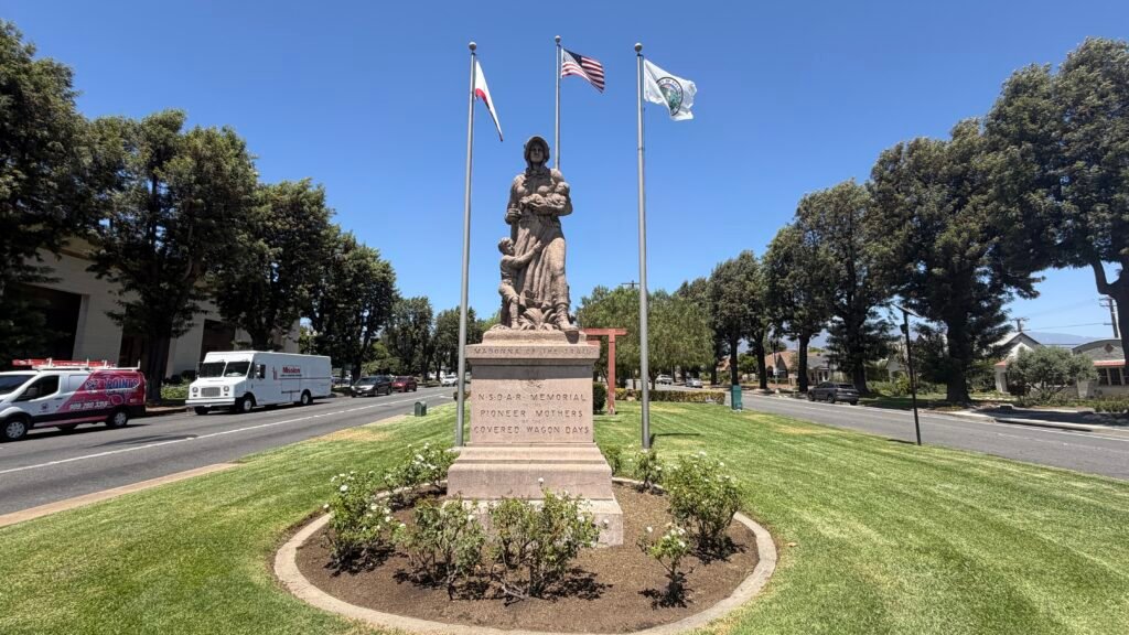
Standing proudly in the tree-lined median of Euclid Avenue in Upland, California, the Madonna of the Trail monument is a striking, 18-foot-tall tribute to the pioneer women who helped conquer the American frontier. Dedicated in 1929 by the Daughters of the American Revolution (with future President Harry S. Truman serving as the national chairman of the memorial association!), this algonite stone statue depicts a pioneer mother in a sunbonnet, clutching a rifle and her baby while her young son clings to her skirt. It is one of a series of 12 identical statues placed in states from Maryland to California along the historic National Old Trails Road, marking the final western stop on this coast-to-coast historic path.
For active seniors, visiting this historic roadside landmark is an easy and comfortable stop. The statue is situated within a lovely, flat, grassy parkway along Foothill Boulevard (Historic Route 66) and Euclid Avenue, offering smooth, level concrete walking paths all around the monument. Benches are positioned nearby under shade trees, making it a pleasant spot to sit and take in the craftsmanship and history. While there are no dedicated public restrooms directly at the outdoor statue itself, the monument is located right in downtown Upland, surrounded by accessible local cafes, shops, and civic centers with restrooms just a short block or two away. I was able to grab free side of the road parking to check this landmark out.
Magic Lamp Inn (RT66)
Location: 8189 Foothill Blvd,
City: Rancho Cucamonga
Region of State Located: South/West
Google Maps Pin
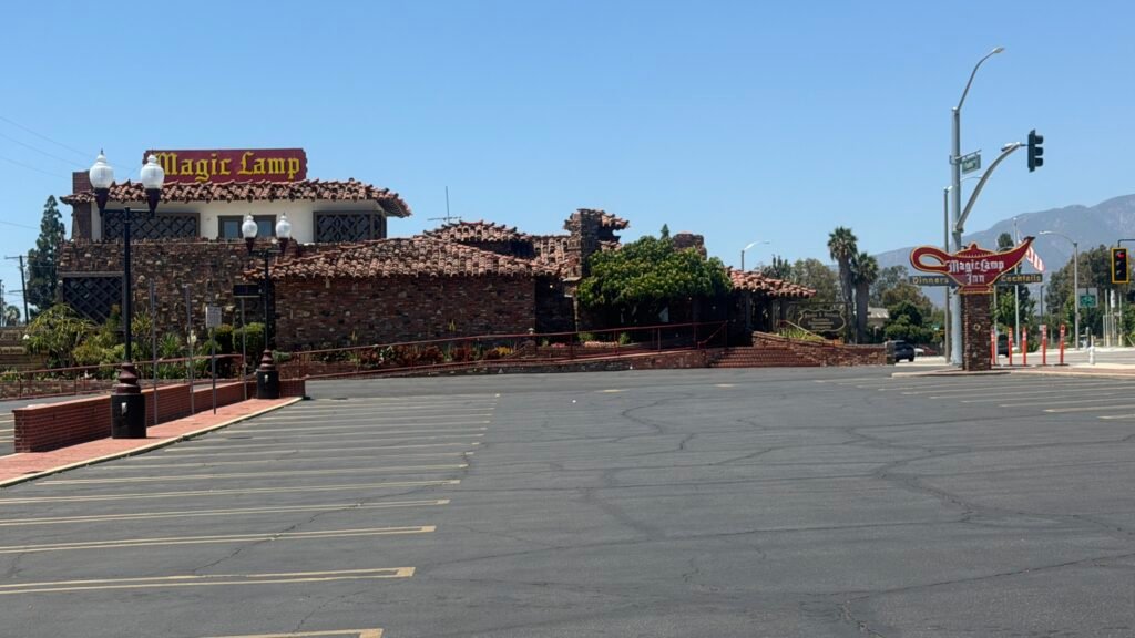
Only one Route 66 sign has an Aladdin’s lamp with a flame shooting out of its spout, and this is it. The Magic Lamp Inn at 8189 Foothill Blvd was founded in 1955 by John Clearman, a restaurateur known for his themed steakhouses, and its sign is a neon lamp with a genuine flame in the spout. The building was a restaurant even earlier, since the 1940s. The place closed in early 2023, underwent about 18 months of renovation, and reopened after a soft opening in fall 2024. It’s now back under new ownership with a fresh menu, live music, and a torch-lit dining room. Sadly, the old flaming desserts are gone, but the flame in the sign is still burning. It’s a perfect spot to pair with the Sycamore Inn, with its “since 1848” neon sign, about a quarter mile down the road, and Vince’s Spaghetti, which is also close.
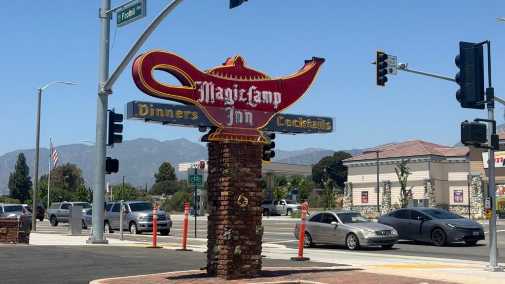
The sign is free to admire from the street and looks best after dark, so aim for dusk. If you want to dine, plan ahead: it’s a steakhouse open Wednesday through Sunday evenings, roughly 5 to 8:30 PM, closed Monday and Tuesday, and reservations are required, according to one listing. Prices run about $50 to $100 per person.
Plank Road
Location: Gray Wells Rd/Off Interstate 8
City: Winterhaven
Region of State Located: Southeast Tip
Google Maps Pin
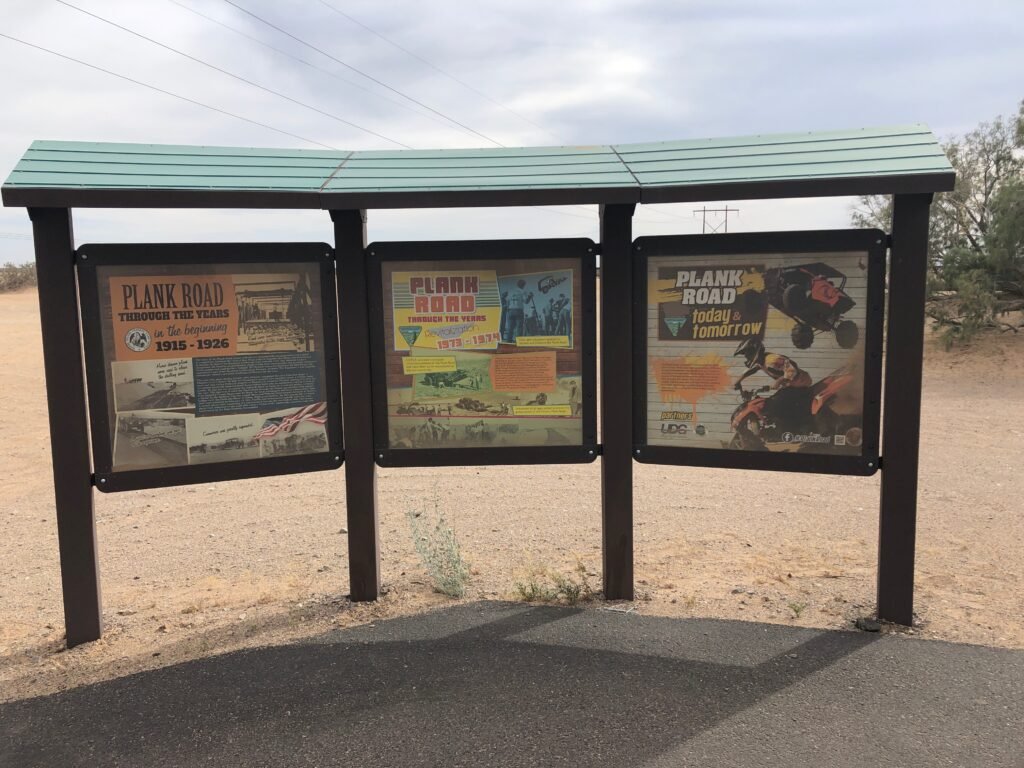
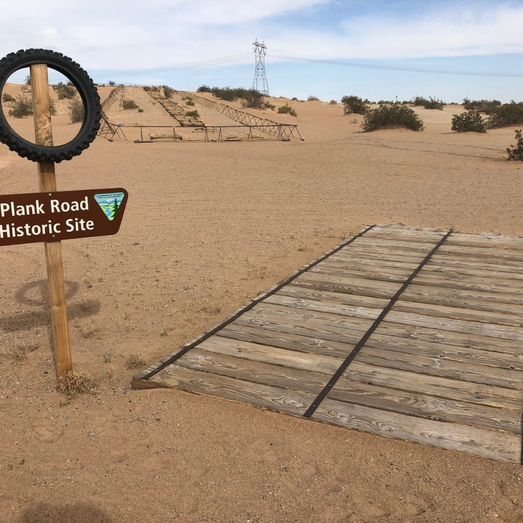
Plank Road in Winterhaven, California is one of those roadside curiosities that makes travelers do a double-take and think, “Wait… was that really a road made of wood?” Back in the early 20th century, before modern pavement stretched across the West, some inventive engineers experimented with wooden plank surfaces to help cars and wagons cross soft, sandy, or muddy ground. What remains near Gray Wells Road just off Interstate 8 is a rare surviving stretch of that old wooden roadway, essentially a time capsule of early automotive ingenuity tucked into the desert.
Today, Plank Road isn’t a high-speed scenic byway, but that’s part of the charm. You can see the aged wood planks still lying in place (or poking up through the dirt), reminding visitors how rough and inventive travel once was. It’s not far from the highway, but it feels like a journey back before asphalt and concrete became the default. Whether you’re a history buff, a roadside explorer, or just someone who enjoys weird bits of infrastructure that most people have never heard of, Plank Road delivers exactly the kind of “only in America” moment that makes road trips memorable. Just don’t expect to drive on it like you would a modern road, this one’s best appreciated on foot and with your camera ready.
Santa Monica Pier (RT 66)
Location: 200 Santa Monica Pier
City: Santa Monica
Region of State Located: South/West
Google Maps Pin
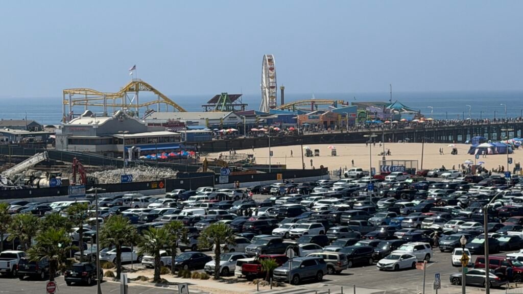
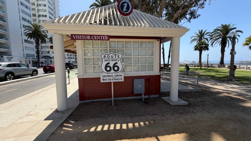
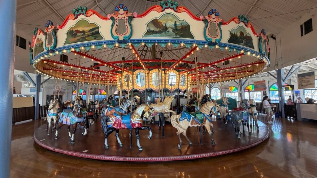
This is the end of the road, at least in spirit. The pier opened in 1909, and its famous “End of the Trail” Route 66 sign was installed in 2009, next to Pacific Park and a visitor center. It was dedicated during the pier’s centennial year and was meant as a tribute to an earlier “End of the Trail” sign that stood over the pier in the 1930s. Here’s the fun technicality: Route 66 technically ends at Lincoln Blvd and Olympic Blvd, but the pier is the spot everyone photographs, so a “spiritual” ending it is. Pacific Park, with its famous Ferris wheel, opened in 1996, and the pier also has a historic 1922 carousel, an old-fashioned soda fountain, and an aquarium. Admission to the pier is free, and it’s open 365 days a year at 200 Santa Monica Pier.
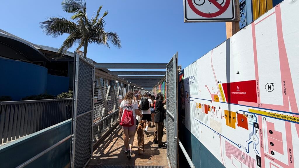
The pier is flat and has plenty of benches, restaurants, and restrooms, so it’s easy for most seniors, though it’s a long walk from the entrance to the end and it gets crowded on weekends and holidays. Weekday mornings are calmer and best for photos at the sign. Parking is the real challenge and you may wind up paying $20 to $35 a day around the pier, so look at nearby garages or rideshare. I used a parking garage several blocks away and walked over. Bring a light jacket, since the ocean breeze is cooler than you’d expect. You can also expect to find street hustlers and panhandlers on the pier, so keep your belongings close.
Seal Statue at Ocean World
Location: 304 US-101
City: Crescent City
Region of State Located: North/West
Google Maps Pin
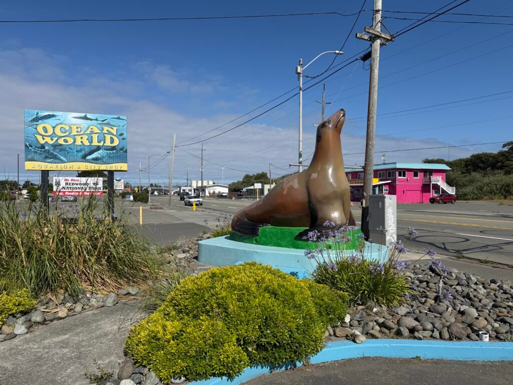
Greeting highway travelers along US-101 in Crescent City, the giant sea lion statue perched outside Ocean World is a classic, oversized piece of coastal Americana that demands a quick roadside photo op. Ocean World originally opened in 1964 as “Undersea Gardens,” built on a converted 250-ton barge towed down from Seattle, before moving inland to its current custom-built aquarium facility. The friendly pinniped statue outside serves as the cheerful mascot for this historic attraction, welcoming road-trippers to check out its famous shark-touch tanks, marine life exhibits, and playful sea lion shows that have delighted generations of coastal travelers.
For active seniors traveling down the Redwood Coast, snapping a picture with this colossal sea lion is as convenient as it gets. The statue sits right outside the entrance on flat, paved ground with no stairs or tricky terrain required to reach it. Plenty of spacious, level parking, including accessible spaces and room for larger vehicles, is available steps away in the main lot. Fully accessible public restrooms and a gift shop are located right inside the main facility if you decide to stretch your legs further. I didn’t go inside. I parked in the parking lot to grab this shot.
S.S. Castle Rock
Location: Intersection of Chinook St & US-101
City: Smith River
Region of State Located: North/West
Google Maps Pin
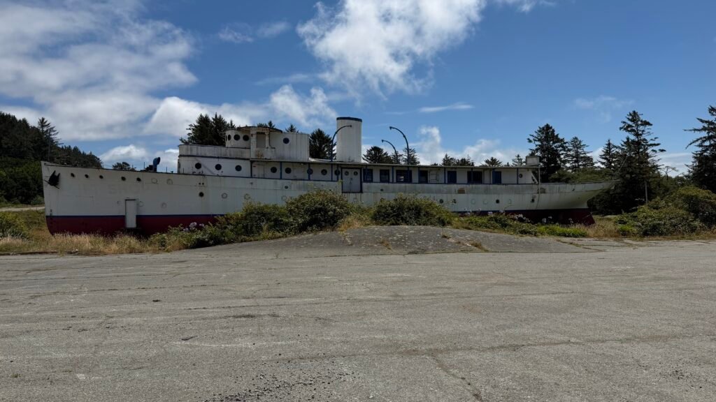
You don’t expect to see a 158-foot ship sitting on dry land a quarter mile from the ocean, but that’s exactly what’s parked at the Ship Ashore Resort on US-101, about three miles south of the Oregon border. The vessel started life in 1925 as the S.S. Caritas, a steel yacht built in Germany for a wealthy New Yorker and outfitted with teak and mahogany interiors. The Navy later bought it and turned it into a weather ship, the U.S.S. Garnett, which served in the Pacific during World War II. When Joe Sierka’s Castle Rock Camp lodge burned down in 1948, he decided the ship would make a perfect replacement. The newly christened S.S. Castle Rock arrived at a Smith River mooring on February 17, 1950. Fifteen years later, 12 tractors spent 10 hours dragging it to Highway 101, where it used to serve as a museum and gift shop for the resort. Not a bad second career for a yacht.
It’s an easy roadside stop, since you can see the whole ship from the parking lot, and a photo is all you need. Unfortunately it’s just rusting away now but I bet it was a pretty cool museum and gift shop when it was open.
Tour Through The Tree
Location: 430 CA-169
City: Klamath
Region of State Located: North/West
Google Maps Pin
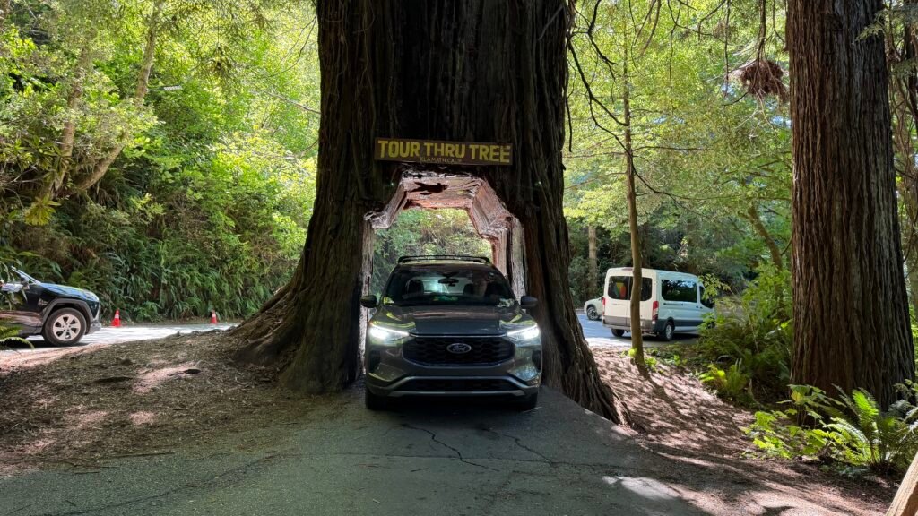
Ever wanted to drive your car right through a living, breathing 800-year-old redwood? If you are in Klamath, you can. The tunnel was carved in May 1976, which makes the opening large enough for bigger vehicles than the nearby Chandelier Tree, and the tree itself was spared when the area was logged in 1967. Here’s the best part of the story: landowner Del Ponte hired two of his nephews to carve the tunnel and offered them either $600 in cash each or half of the annual proceeds. They took the cash, never imagining it would become a tourist attraction, and the tree now draws about 60,000 vehicles a year. Whoops. The name is no accident either: it’s called the “Tour-Thru” Tree to avoid legal entanglements with the “Drive-Thru” Tree. The park also has picnic tables, a gift shop, and a restroom made from a hollowed-out redwood, plus a pack of emus in the field across the street.
Admission was $20 per car which is a little steep to drive through a tree . Hours are daylight, and the phone number is 707-482-5971. One tip: no trailers or large motorhomes, and expect a slow line of cars on the narrow, uphill road to the tree. If you don’t want to get a picture of your vehicle going through the tree (or if it’s to large) you can park at the admissions gate and walk up the hill, which is very doable for most seniors as it’s not that long a walk. Have a passenger hop out to snap the “car in the tree” photo, and consider going early in the day to beat the crowds. Plan on a little bit of a wait as each car that goes through seems to have lots of people in them and everyone wants their photo taken. You will need to be very patient.
Twin Totem Pole #1
Location: 301 Sorensen Ave (CA 111)
City: Calipatria
Region of State Located: Southern Tip
Google Maps Pin
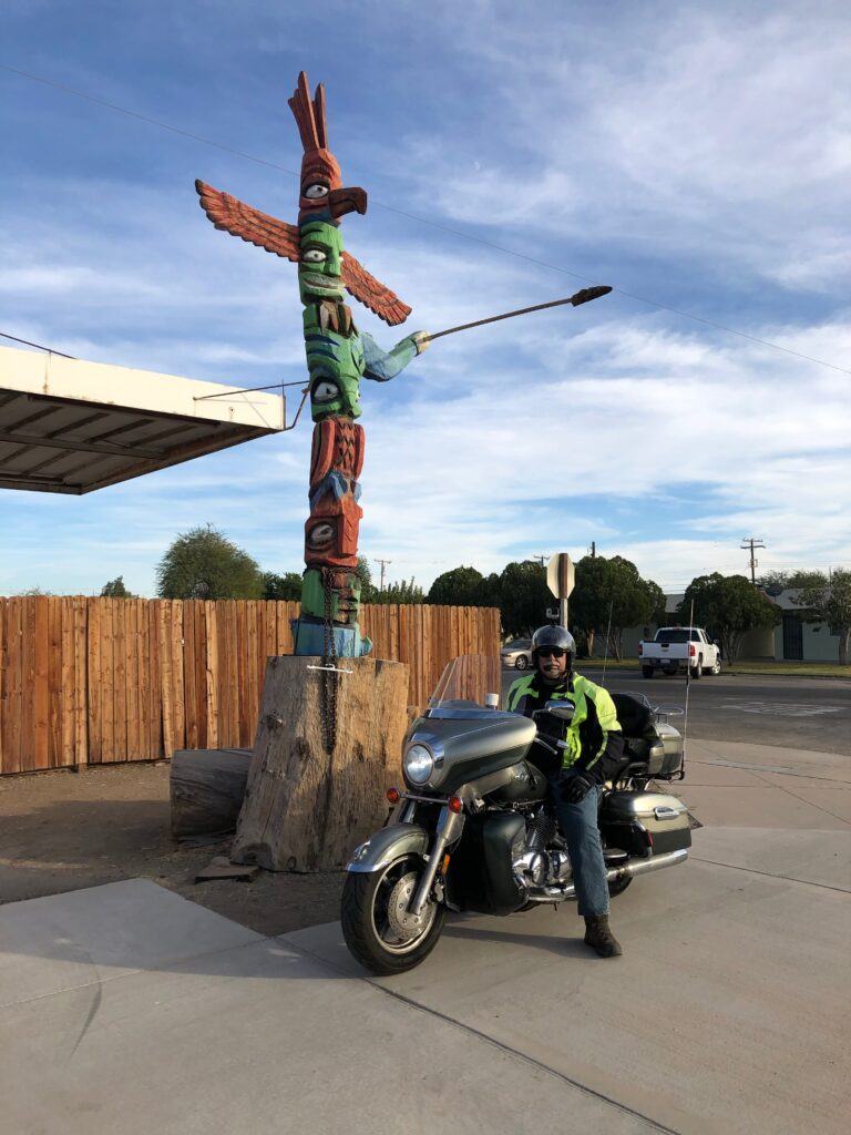
Sometimes the best roadside oddities aren’t on any map, they’re the ones you discover by accident while heading home from somewhere else. That’s exactly how these unexpected totem poles in Calipatria, California came into view. Located outside what was once Archie’s Place (now Birrieria La Patria) along Highway 111, two tall, colorful totem poles stand quietly near the roadside, catching the attention of anyone who happens to be paying attention instead of just cruising past. In the middle of flat desert farmland, seeing something that looks straight out of the Pacific Northwest feels delightfully out of place.
No plaques, no gift shop, and no official explanation, just two hand-carved figures standing guard outside a local business, doing their job as accidental landmarks. Whether they were meant as artwork, decoration, or simply a way to make the building impossible to miss, they’ve become a memorable roadside curiosity. It’s the kind of stop where you pull over, snap a few photos, shrug, and smile, because sometimes the best travel moments don’t come with a backstory. They just show up when you least expect them and make your ride a little more interesting.
Twin Totem Pole #2
This one was located next to the one listed above
Use the buttons above to explore more roadside oddities, road trips, parks, and campground and lodging for active adults. If you found it helpful, share it with someone who believes the journey is just as much fun as the destination. Want more travel destinations, active senior lifestyle information, and the occasional bad joke? Subscribe below and I’ll send you one friendly update the last Friday of the month. No spam, just helpful content and a little encouragement for the road ahead.